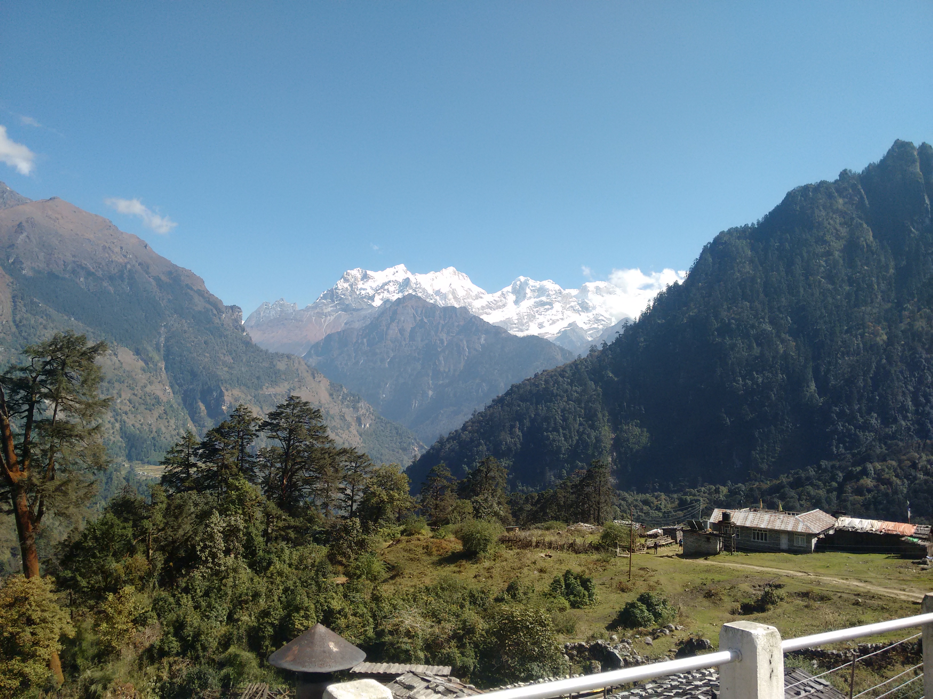

The Manaslu Circuit Trek 14 Days package is the most practical and widely booked itinerary for anyone wanting to walk around Mount Manaslu, the world's eighth-highest peak. Tucked away in the Gorkha district of west-central Nepal, this trail circles the mountain rather than heading straight toward its base camp, which means every day brings a different landscape instead of a repeated climb through the same valley. In two weeks, you'll walk through subtropical river valleys, pine and rhododendron forests, high alpine yak pastures, and traditional Tibetan-influenced villages, before crossing the dramatic Larkya La Pass at 5,106 meters. It's a trek that rewards patience — the scenery builds slowly, village by village, until the final push over the pass delivers one of the most satisfying mountain panoramas in the Nepal Himalaya.
What sets this route apart from Nepal's more famous circuits is how little it has changed. While roads have crept into large sections of the Annapurna Circuit and lodges along the Everest trail have grown increasingly upscale, Manaslu remains a government-restricted region, which has kept development, traffic, and tourist numbers naturally in check. That restriction isn't a downside — it's the reason the trail still feels wild. You'll pass through villages like Namrung, Lho, and Samagaon where daily life still centers on farming, yak herding, and Buddhist monastery routines rather than tourism, and where a stone mani wall or a fluttering string of prayer flags feels earned rather than staged for visitors.
The 14-day structure exists for a good reason: it gives your body the time it actually needs to adjust to the altitude, while still keeping the trip tight enough to fit into a standard two-week holiday. Shorter versions of this trek exist, but they compress the acclimatization schedule in a way that raises the risk of altitude sickness right when you need to be at your sharpest, on the climb toward Larkya La. This itinerary spaces out the elevation gain sensibly, builds in a dedicated rest day at Samagaon, and keeps a buffer day near the end in case weather or trail conditions call for a change of plan. The result is a trek that's demanding, but realistically achievable for anyone with decent fitness and a genuine sense of adventure.
Day 1: Drive from Kathmandu to Machha Khola
Duration: 7–8 hours | Altitude: 930 m
The trek begins with a long but scenic drive out of Kathmandu, following the Prithvi Highway before turning north toward the hills of Gorkha. The road winds alongside the Trishuli and Budhi Gandaki rivers, passing terraced farmland and small roadside villages. The last stretch into Machha Khola is rougher, so expect a bumpy final hour. This is your first night in a teahouse and a good chance to settle in before the walking starts.
Day 2: Machha Khola to Jagat
Duration: 6–7 hours | Altitude: 1,340 m
The real trekking begins here. The trail follows the Budhi Gandaki river closely, crossing several suspension bridges and passing through small Gurung settlements. You'll walk through forested sections and past waterfalls, with the valley narrowing as you gain height. Jagat is a stone-paved village and also the checkpoint where your permits are first verified.
Day 3: Jagat to Deng
Duration: 6–7 hours | Altitude: 1,860 m
The trail continues deeper into the gorge, crossing back and forth over the river on suspension bridges and climbing through pine forest. You'll pass the village of Philim, where the trail briefly splits toward Tsum Valley, before continuing on the main Manaslu route. The scenery starts to feel noticeably more remote from here.
Day 4: Deng to Namrung
Duration: 5–6 hours | Altitude: 2,630 m
This is a transition day, both in landscape and culture. As you climb, the trail moves from subtropical forest into cooler, pine-covered slopes, and you'll begin to notice Tibetan-Buddhist influence in the architecture, prayer flags, and mani walls. Namrung marks the entry into the upper Manaslu region and has one of the better-equipped villages on the route.
Day 5: Namrung to Lho
Duration: 4–5 hours | Altitude: 3,180 m
A shorter but steadily uphill day that offers your first real mountain views, including glimpses of Manaslu itself on clear mornings. Lho is a beautiful village with a large monastery and a stupa positioned perfectly for photographs, with Manaslu rising dramatically behind it.
Day 6: Lho to Samagaon
Duration: 3–4 hours | Altitude: 3,530 m
A relatively easy, shorter walking day, which helps with gradual acclimatization. Samagaon is the largest village in the upper Manaslu region and sits in a wide, open valley with excellent close-up views of Manaslu. You'll spend two nights here to acclimatize.
Day 7: Acclimatization Day in Samagaon
Altitude: 3,530 m
A rest day that isn't really about resting — it's about climbing higher during the day and sleeping lower at night, which helps your body adjust to the altitude. Most trekkers use this day for a side hike to Manaslu Base Camp or up to Pungyen Gompa, both offering spectacular close-range views of the mountain and its glaciers.
Day 8: Samagaon to Samdo
Duration: 3–4 hours | Altitude: 3,860 m
A shorter, gentler walking day through open alpine terrain and yak pastures. Samdo is one of the last permanent settlements on the route and has a strong Tibetan character, having historically been a trading point with Tibet, which lies just over the nearby ridgeline.
Day 9: Samdo to Dharamsala (Larkya Phedi)
Duration: 4–5 hours | Altitude: 4,460 m
The trail leaves the last of the villages behind and climbs into high alpine, glacial terrain. Vegetation thins out almost completely, and the landscape becomes rugged and open. Dharamsala (also called Larkya Phedi) is a basic, high-altitude lodge stop positioned specifically for the pass crossing the next morning.
Day 10: Dharamsala over Larkya La Pass to Bimthang
Duration: 8–9 hours | Altitude: 3,720 m (pass: 5,106 m)
The most demanding and most rewarding day of the trek. You'll start well before sunrise to cross the Larkya La Pass while winds are calmer and the snow is firmer underfoot. The climb to the top is steep and requires steady pacing, but the summit rewards you with sweeping views of Himlung Himal, Cheo Himal, and Kang Guru. The descent into Bimthang, on the Annapurna side of the pass, is long but drops you into a stunning alpine meadow framed by glaciers.
Day 11: Bimthang to Dharapani
Duration: 6–7 hours | Altitude: 1,960 m
A long descent through forest and farmland, rejoining the more established Annapurna Circuit trail network. The change in scenery and infrastructure is noticeable — Dharapani has road access, marking the practical end of the remote trekking section.
Day 12: Dharapani to Kathmandu (Drive via Besisahar)
Duration: 8–9 hours | Altitude: 1,400 m
A full day of driving back to Kathmandu, typically via Besisahar and the Prithvi Highway. It's a long journey, so it's worth resting and enjoying the mountain views along the way before returning to the city.
Day 13: Reserve/Buffer Day
This day is deliberately kept unscheduled to absorb any delays caused by weather, road conditions, or an early pass closure at Larkya La. If your trek has gone smoothly, this becomes a free day in Kathmandu for sightseeing, shopping, or simply resting before your flight home.
Day 14: Final Departure
Transfer to Kathmandu's Tribhuvan International Airport for your departure flight, or connect onward to your next destination.
*****
The Manaslu region is a government-restricted area, which means the permit process is stricter than open trekking regions like Everest or Langtang. You will need:
You cannot apply for the RAP independently — it must go through a licensed Nepali trekking company, and you're legally required to trek with a guide and in a group of at least two people.
This trek is rated moderate to challenging. It's not technical — there's no climbing gear involved — but it demands solid stamina and mental readiness for high-altitude trekking. Key difficulty factors:
Prior trekking experience is not mandatory, but a reasonable fitness level (able to walk 5–7 hours a day on hilly terrain) will make the experience far more enjoyable.
Yes. Fourteen days is the standard, well-tested itinerary length that includes proper acclimatization and a buffer day, making it a safer and more comfortable option than faster 10–11 day versions.
No prior technical experience is required, but a good base level of fitness is strongly recommended given the long daily walks and the high-altitude pass crossing.
Both treks are considered safe when done with a licensed guide and proper acclimatization. Manaslu's restricted-area rules — mandatory guide and minimum group size — add an extra layer of safety and support compared to independently trekked routes.
No. Because Manaslu is a legally restricted trekking area, a licensed guide is mandatory, and solo trekking is not permitted.
The Larkya La Pass, at 5,106 meters, is the highest point and the most physically demanding day of the trek
| No of person | Price |
|---|---|
| 2- 3 people | $ 960 |
| 4-6 person | $940 |
| 7-10 person | $930 |
| 11 - 15 person | $925 |